

Suggested Itineraries
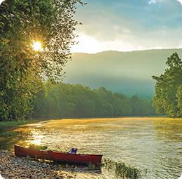
If you’ve seen the Blue Ridge Mountains from a scenic overlook or while driving along a quiet back road, it’s time for a totally new perspective – river level.
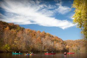
The Upper James River Water Trail meanders through beautiful Botetourt and Rockbridge Counties. The trail is organized into sections, each offering a unique river experience. Select a section to explore and experience unspoiled natural beauty as you float through scenic valleys and rolling farmland. Keep your eyes and ears open for wildlife and enjoy views of the Blue Ridge Mountains. Some Class I, II and III rapids along your journey will provide thrills for all members of the family.
James River:
Iron Gate to Glen Wilton
This 2.5 mile (1 – 1.5 hours) float features quick current and impressive mountain views. The trip starts at the Iron Gate boat launch below the route 220 bridge about 1 mile below the confluence of the Jackson and the Cowpasture rivers. This trip contains several easy Class I rapids and one Class II rapid. The trip ends at a gravel shoreline access under the route 622 Glen Wilton Bridge.
Glen Wilton to Gala
This 7.5 mile (3 – 4 hours) float features numerous Class I rapids, as well as one Class II rapid locally called “the Squeeze”, and should be carefully scouted before being paddled. The trip features good views of Patterson Mountain along the way, as well as some impressive cliffs upstream of Gala. The trip ends at the Gala boating access located on Sinking Creek about 100 feet past the railroad bridge.
Gala to Craig Creek
This 4 mile (1 – 2 hours) short float has plenty of easy Class I rapids to enjoy. This trip starts on Sinking Creek from the Gala boating access and enters the James River under a railroad bridge. There are plenty of rapids along this stretch to make this a fun quick trip option. This float is also popular for fishing and river tubing. The trip ends at the DGIF Craig Creek gravel shoreline access in Eagle Rock on river right.
Craig Creek to Horseshoe Bend
This 13 mile (5 – 7 hours) float has numerous Class I rapids and a few very easy Class II rapids along the way. The trip is the most remote of all of the trips in the Upper James River Water Trail and was ranked by Blue Ridge Outdoors magazine as one of the best Class I trips in the Southeast. This trip also includes some of the most impressive remains of the James & Kanawha River Canal (All located on private property so please view them from the river only). This trip makes a great full day float, but be sure to bring food and water and remember to pack out what you pack in.
Horseshoe Bend to Springwood
A 3.5 mile (1 – 1.5 hours) float, this short and fun trip containing several Class I rapids and a moderately challenging Class II rapid known as Ritchies Falls about 15 minutes into the float. Some folks also tube this section, but it can take several hours in low water. This trip is typically combined with the Springwood to Buchanan trip to make a longer 8.5 mile trip on the river.
Springwood to Buchanan
 This 5 mile (2 hours) trip is one of the easier floats in Botetourt County; great for first time paddlers or folks fishing. This trip contains a few easy Class I rapids including a ½ mile section of swift water with Class I rapids about 10 minutes into the trip with another stretch of Class I rapids below the I-81 Bridge. The middle section of this trip is mostly flat water with some impressive views of Purgatory Mountain. This trip is very popular for Smallmouth bass and Muskie fishing. This trip starts at the Springwood boat landing and ends at the public boat landing in downtown Buchanan just above the swinging bridge.
Buchanan to Arcadia
This 6 mile (2 ½ hours) float is a fun float with good rapids and current. The trip includes three Class II rapids that can be challenging in higher water conditions (above 4 ft on the Buchanan River gauge). The trip is very popular with local paddlers, especially on weekends. The trip features some impressive mountain views and is fairly remote once you leave the Buchanan area. Remains of Wasp Dam from the James & Kanawha Canal era can be found about 3 miles into the trip on river left. Trip ends at the Arcadia boat landing (on river right) under the Arcadia (Route 614) bridge.
Arcadia to Alpine
This 4.5 mile (1 – 2 hours) section contains several easy Class I rapids and two fun Class II rapids at normal water levels. This part of the river is remote and has some great mountain views. This stretch is also excellent for smallmouth bass fishing. This section is routinely combined with the Buchanan to Arcadia section, making a great full day 10.5 mile float.
Alpine to Glasgow
This 11 mile (4 – 6 hours) section features numerous Class II rapids, stretches of calm water, and borders the George Washington National Forest. This section offers excellent mountain views as the James River meanders along the base of the Blue Ridge Mountains. The takeout at Glasgow is river left via timber steps just before the James River’s confluence with the Maury River.
Glasgow to Snowden
This 4.7 mile (2 – 3 hours) section is the most scenic section of the Upper James River Water Trail. This section is also the most technical and not recommended for beginners. A rock garden begins approximately a mile downriver of Glasgow and marks the beginning of the whitewater section, which includes numerous Class I, II and III rapids. Caution! Paddling this section is not recommended when the James River gauge at Buchanan is above 4.5 ft. Rapids become Class VI at higher river levels.
Maury River:
Glen Maury Park to Glasgow
This 12 mile (4 – 5 hours) trip is on the Maury River. It contains numerous Class I and II rapids, and should not be run by inexperienced paddlers. This river is typically only runable in the spring or after a rain event. Paddlers should check the Buena Vista – Maury River gauge prior to paddling this section. Recommended gauge levels are 2.0 to 3.5 ft. Large, challenging wave fields and very strong currents develop at higher water levels.
More paddling opportunities in the scenic mountains of Virginia can be found in the Alleghany Highlands, including on the Jackson and Cowpasture rivers which meet to form the mighty James River. Visit www.alleghanyhighlandsblueway.com for more details.