

Attractions
In Botetourt County:
 Roaring Run Recreational Area (Falls and historic furnace)
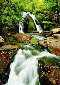
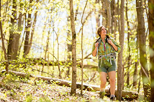
Looking for a fun hike that features a natural water slide? Roaring Run Falls and Furnace Trail is an excellent hiking trail for the whole family. Two trails lead to the falls creating a 1.5 mile loop trail and the easy, well-marked trail begins at an historic iron furnace and winds back and forth along the Roaring Run stream. You will pass rock walls, cascading water, and cross five footbridges before ending at beautiful Roaring Run Falls.
Directions: From Eagle Rock, VA take US 220 north and turn left on Craig Creek Road (SR 615). Continue for 5.5 miles. Turn right on Roaring Run Road (SR 621). Travel one mile to entrance of Roaring Run Day Use Area.
Difficulty: Easy
Trail Length: 1.40 miles
Elevation: 1200 to 1300 feet
More Information:
www.fs.usda.gov/recarea/gwj/null/recarea/?recid=79950&actid=50
www.visitbotetourt.com
www.roanokeoutside.com
www.visitvablueridge.com
Botetourt County Parks and Recreation: 540-928-2130
 Greenfield Trail System
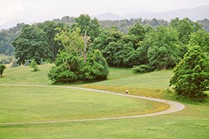
The Greenfield Trail System is a 125-acre park with access to hiking, horseback riding, children’s playground and sports fields. Within the park, you can access the Bowyer-Holladay Trail, the Cherry Blossom Trail, the Colonel William Preston Trail, and the Greenfield Recreational Trail.
More Information:
www.visitbotetourt.com
www.roanokeoutside.com
www.visitvablueridge.com
Botetourt County Parks and Recreation: 540-928-2130
 Greenfield Disc Golf Course
Opened May 2014, the Greenfield Disc Golf Course is the only 18-hole course in the area. Already ranking in the Top 20 in the world, GDGC features hill top tee boxes to foot bridges across the creek to the target, GDGC captures the true essence of outdoor recreation.
Each hole features three marked boxes based on experience level and difficulty to begin. Each hole features a metal basket. If you’re interested in playing and don’t have your own discs, no worries. GDGC stores extra discs at the course welcome sign near tee #1 with discs you can use and return, no charge. Please respect the course and other players while visiting.
More Information:
www.visitbotetourt.com
www.roanokeoutside.com
www.visitvablueridge.com
Botetourt County Parks and Recreation: 540-928-2130
 Appalachian Trail
The Appalachian National Scenic Trail, generally known as the Appalachian Trail or simply the A.T., is a marked hiking trail in the eastern United States extending between Georgia and Maine. The trail is approximately 2,200 miles long. The trail passes through the states of Georgia, North Carolina, Tennessee, Virginia, West Virginia, Maryland, Pennsylvania, New Jersey, New York, Connecticut, Massachusetts, Vermont, New Hampshire, and Maine.
The Appalachian Trail is famous for its many hikers, some of whom, called thru-hikers, attempt to hike it in its entirety in a single season. Access points can be found throughout Botetourt County, though the two most accessible areas are in the Town of Troutville, a designated AT Community, and in the area of Daleville. Each location has parking available to hikers.
More Information:
www.appalachiantrail.org
www.visitbotetourt.com
www.roanokeoutside.com
www.visitvablueridge.com
Botetourt County Parks and Recreation: 540-928-2130
In Rockbridge County:
 Natural Bridge State Park
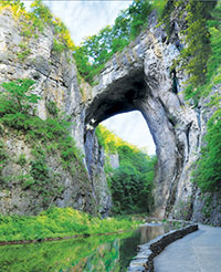
The 37th Virginia State Park, affiliated unit of the National Park Service, and Virginia treasure is more than just the Bridge. Once owned by Thomas Jefferson and listed on the National Register of Historic Places, the 215-foot tall Natural Bridge is a limestone arch and gorge carved out by Cedar Creek. Enjoy 6 miles of various hiking trails, including the accessible Cedar Creek Trail leading from the Bridge to the Monacan Indian Village and Lace Falls with its 30-foot cascade.
Hours: Open daily 8am – dusk. $6 ages 6-12 and $8 ages 13 & up.
Directions: 6477 S. Lee Highway, Natural Bridge, VA 24578. From I-81, take exit 175 or 180A to U.S. 11 and follow signs to the park.
Difficulty: Easy to Moderate
More Information:
lexingtonvirginia.com/directory/attractions/natural-bridge-state-park
www.dcr.virginia.gov/state-parks/natural-bridge#general_information
Phone: 540-291-1326
 Virginia Safari Park
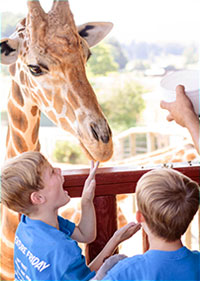
A 180-acre drive-thru adventure featuring over 1,000 free roaming animals from around the world. Drive your vehicle over 3 miles of maintained gravel road and feed the animals through your windows! Seasonal wagon tours available. Stoll the paved walkways of the 10-acre walk-thru Safari Village, visiting habitats and interacting with animals at the Giraffe Feeding Station, Budgie Aviary, Kangaroo Walk-About and the Petting Barn. Come feed, pet and enjoy!
Visit website for seasonal hours of operation and ticket prices.
Directions: 229 Safari Lane, Natural Bridge, VA 24578. From I-81, 180/ 180-B to U.S. 11 and follow signs to the park. (Look for Stop-In gas station and KOA campground)
More Information:
lexingtonvirginia.com/directory/attractions/virginia-safari-park
www.virginiasafaripark.com
Phone: 540-291-3205
 Blue Ridge Parkway
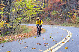
America’s favorite scenic drive offers overlooks, trails, picnic and camping areas for those traveling by car, motorcycle or bicycle. Spanning 469 miles from Virginia to North Carolina, there are three access points in Rockbridge County: Vesuvius/ U.S. Route 56 (MP 27.2); Buena Vista/ U.S. Route 60 (MP 45.6); and Glasgow/ U.S. Route 130 (MP 61.4). Certain sections may be closed during inclement weather.
More Information:
lexingtonvirginia.com/articles/blue-ridge-parkway
www.blueridgeparkway.org
Blue Ridge Parkway Association: 828-298-0398
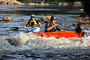 Goshen Pass
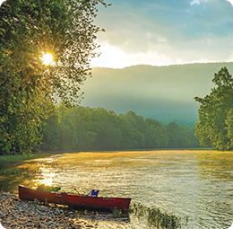
The oldest state-managed natural area in Virginia, Goshen Pass is a magnificent mountain gorge three miles long that was formed by the Maury River. Visitors here enjoy a picnic pavilion, swimming, tubing, canoeing, fishing, picnicking and walking the trail on the north side of the river.
This part of the Maury River is some of the most popular whitewater in Virginia and is rated at a high difficulty. Kayakers and canoers can experience six miles of numerous class II, class III, and two class IV rapids, specifically Devil’s Kitchen and Corner Rapid.
Directions: 12 miles west of Lexington on Rt. 39. From I-81, merge onto I-64 W, exit 55 to Rt. 11 N, immediate left turn onto Rt. 39. Numerous access points to the water from Rt. 39.
More Information:
lexingtonvirginia.com/outdoors/activities/attractions/goshen
www.dgif.virginia.gov/wma/goshen-and-little-north-mountain/
Virginia Department of Game & Inland Fisheries: 540-899-4169 or 540-248-9360