
 About the Water Trail
 About the Water Trail
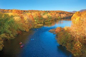 The Jackson and Cowpasture Rivers converge in northern Botetourt to form Virginia’s greatest river, the James River. These headwaters provide some of the finest canoeing and freshwater fishing available in Virginia. A 59-mile stretch of the James River from its headwaters in Botetourt County to Glasgow in Rockbridge County was recently designated a Virginia Scenic River.
The unspoiled beauty of the river is more accessible than ever through the Upper James River Water Trail.
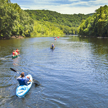
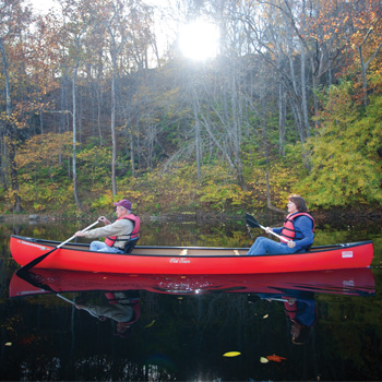
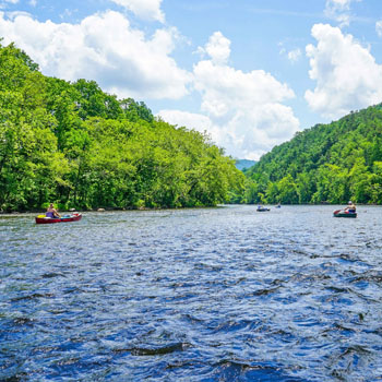
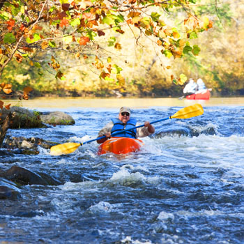
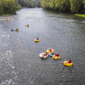
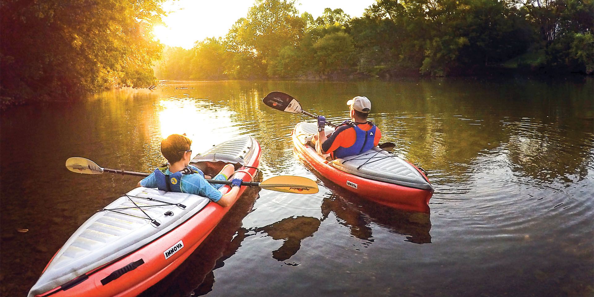
Along 64 miles of the Upper James River in Botetourt and Rockbridge Counties and 10 miles of the Maury River, you can get up close and personal with the Allegheny and Blue Ridge Mountains. You’ll experience the unspoiled beauty of the river as you paddle through scenic valleys and past rolling farmland while keeping a watchful eye out for native wildlife. Some Class I and Class II rapids along your journey will make it a fun day for all members of the family by canoe, kayak or tube.
What is a Water Trail?
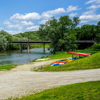
 A “water trail” or “blueway” is a small boat or paddling route along a waterway that combines recreation and environmental awareness while linking communities and land-based attractions such as historic sites and parks. The Upper James River Water Trail was created by Botetourt County to encourage residents and visitors to experience the beauty and history of one of the county’s greatest natural treasures.
The mighty James River finds its source at the confluence of the Jackson and Cowpasture rivers in Botetourt County. These headwaters commonly known as the Upper James River have played an important role in the economies of the communities located along the river. Historically, the river was used as a transportation system with a series of locks and canals used to carry goods downstream towards Lynchburg. Today, the river is a recreational corridor used for fishing, canoeing, kayaking and water viewing along its 64-mile stretch in Botetourt and Rockbridge Counties. The major assets of the Upper James River include its scenery, world-class bass fishing, friendly small town atmosphere and its rich history and diverse character.
In order to capitalize on the many assets of the Upper James, Botetourt County has begun to undertake a strategic analysis to improve, enhance and preserve the environmental, historic and recreational opportunities on the river for the enjoyment of future generations. The goal is to create a water-based trail system that will link the different assets found on the river to form the Upper James River Water Trail.
History of the James River
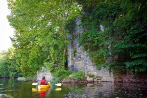 The James has always had a vital role in the culture and commerce of the communities through which it flows. George Washington envisioned connecting east to west through a system of dependable river travel. He personally surveyed sites for locks and canals on the James River as far west as Eagle Rock. Elevated towpaths used by horses and mules to pull barges are still visible along parts of the river and the remains of locks built by immigrant stonemasons using rock quarried from the nearby mountains can still be seen today.
A Virginia Scenic River
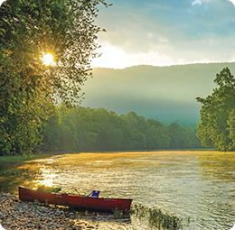
![]() 59-miles of the Upper James River from Eagle Rock to Glasgow are designated as a Virginia Scenic River by the Virginia Department of Conservation & Recreation. The entire Maury River, including the stretch through Lexington and Buena Vista that is part of the water trail, is also designated at a Virginia Scenic River. The designation is only given to rivers and streams that possess outstanding scenic, recreational, historic and natural characteristics. This important designation will help protect the wild beauty of the Upper James for generations to come.
59-miles of the Upper James River from Eagle Rock to Glasgow are designated as a Virginia Scenic River by the Virginia Department of Conservation & Recreation. The entire Maury River, including the stretch through Lexington and Buena Vista that is part of the water trail, is also designated at a Virginia Scenic River. The designation is only given to rivers and streams that possess outstanding scenic, recreational, historic and natural characteristics. This important designation will help protect the wild beauty of the Upper James for generations to come.
A Part of the Chesapeake Bay
 The Chesapeake Bay — the largest estuary in the United States — is an incredibly complex ecosystem that includes important habitats and food webs. The Bay and its rivers, wetlands and forests provide homes, food and protection for diverse groups of animals and plants. Fish of all types and sizes either live in the Bay and its tributaries year-round or visit its waters as they migrate along the East Coast.
The Chesapeake Bay Gateways Network is a system of over 130 of the Chesapeake Bay’s special places.
Chesapeake Bay Gateways are the places to experience, first-hand, Chesapeake life and culture. Gateways are the Bay’s hidden treasures – each communicating a unique relationship and story of the Chesapeake. Gateways are parks, wildlife refuges, maritime museums, historic sites and water trails. They are places you can go to explore, enjoy, relax, learn or simply renew your spirit.
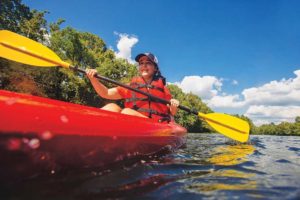
Plan a Trip
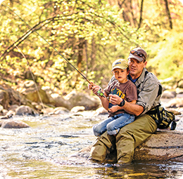
To some that means a carefree float in a tube and chatting with friends on a hot summer day. For some, that means casting a fly in search of a trophy catch. For others, it means packing a lunch and enjoying some undisturbed time canoeing with the whole family. Chances are, a portion of the Upper James has exactly what you’re looking for. If you’re bringing your own canoe or kayak, there are numerous public access points with free parking. For those who need gear, private outfitters are ready to help make your trip a memorable experience with expert advice, equipment rental and shuttle service.